- Ploučnice Bike Path
You will start your cycling trip at the train station in Křižany, which you can easily reach by train with your bike from Liberec, Česká Lípa, Mimoň, or even Děčín – the train schedule is available here. The first stage leads to the main source of the Ploučnice River near the town of Osečná. The route then continues through the picturesque landscape of Podještědí, partly on side roads with little traffic and mostly on paved (mostly asphalt) forest roads (without car traffic). The destination of the first stage is the town of Hamr na Jezeře.
For the first stage of the journey along the Ploučnice River, it is possible to choose other starting points (variants). Variant A, starting in Křižany, is recommended due to its good accessibility by train and favorable terrain (the only climb is at the beginning of the stage on the way from Křižany). Map of stage 1 available here. Other options for the start of the stage are listed below.
Option B starts at the main train station in Liberec and leads through the picturesque Kryštofovo Údolí (see map), then continues through Křižany to Osečná and the source of the Ploučnice River. After that, the stage is the same as option A. A map of the entire option B is available here.
In Liberec, you can take cycle bus no. 270 (timetable available here) to the Světlá pod Ještědem – Semerink stop, where you can connect to cycle route no. 15 – Ploučnice Cycle Route and continue by bike through Druzcov to Osečná and the source of the Ploučnice River. The bike bus, which can carry up to 30 bikes, only runs on weekends and holidays and can also be used to travel to Osečná, from where it is only a short distance to the source of the Ploučnice River. The rest of the route is the same as in option A. A map of option C is available here.
A more demanding option with a climb to the top of Ještěd. The stage starts in Liberec and heads towards the top of Ještěd. After conquering this dominant feature of the region, the cycle route continues via Druzcov and Osečná to the source of the Ploučnice River. The rest of the stage is identical to option A. A map of option D is available here.
Another variant starts in Liberec, from where a chairlift runs from the Horní Hanychov district to Černý kopec (bike transport is free with a purchased ticket). From there, the route leads to the Pláně crossroads and then along cycle route No. 15 to Druzcov, to the source of the Ploučnice River and to Osečná, from where the route is identical to option A. A map of option E is available here. Current information on cable car operations can be found here.
The main source of the Ploučnice River is located between the villages of Janův Důl and Osečná. It can be found at an altitude of 390 metres at the Jenišovský...
Show more
Dozens of attractions in one place offers Liberec, the North Bohemian town under Ještěd. It will delight lovers of history and cultural monuments, active tourists and families with children. You...
Show more
The town of Osečná is situated on the southern side of the Ještěd Mountains and on the edge of the Ralská Hills, at an altitude of 379 m above sea...
Show more
Ještěd is an original building, admired both at home and abroad. At an altitude of 1012 metres above sea level, the tower, built in the 1970s by architect Karel Hubáček,...
Show more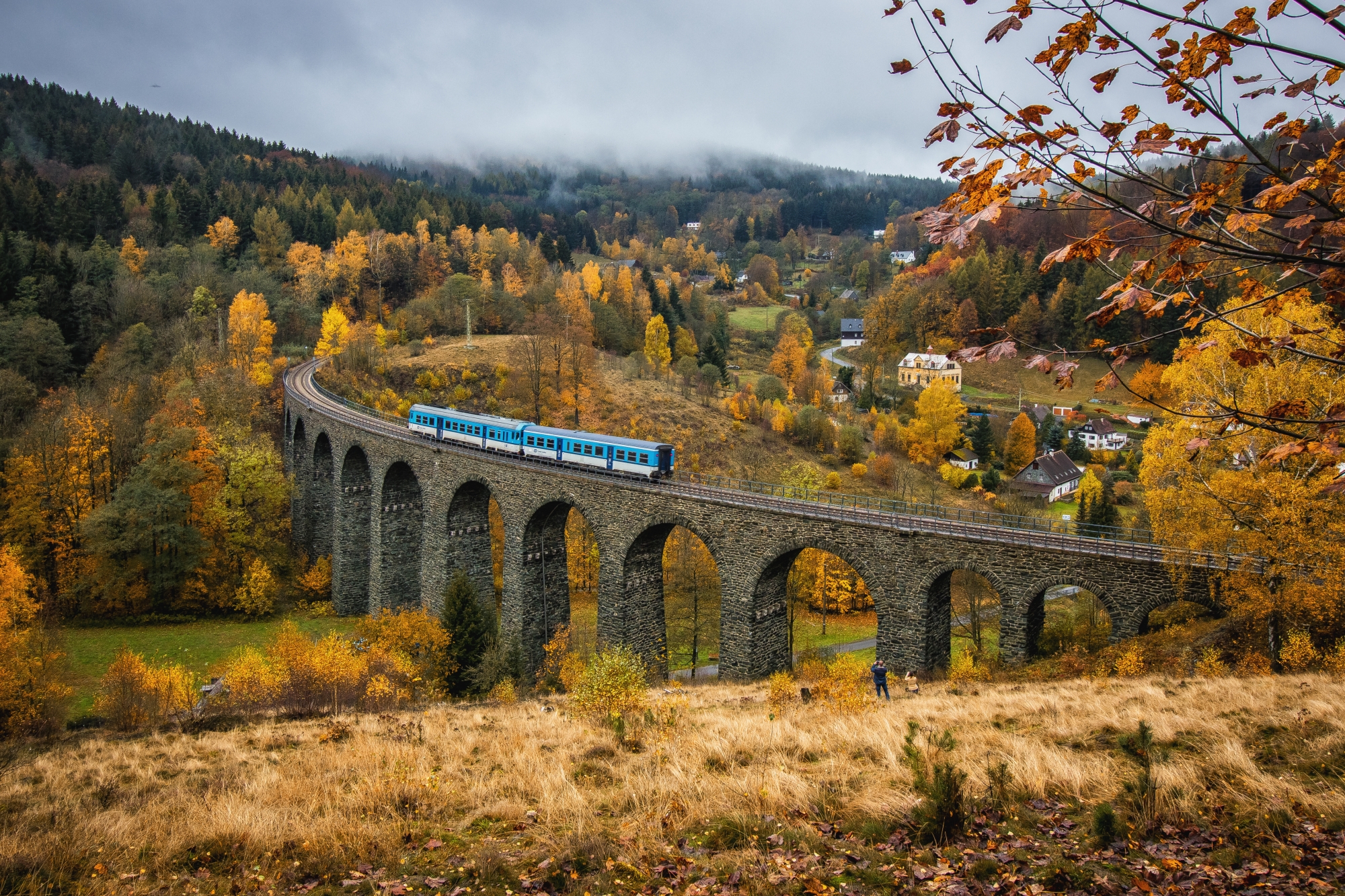
In the settlement of Novina there is a unique technical monument from 1900. It is thirty meters high, 202 meters long and has fourteen supporting columns. The viaduct does not...
Show more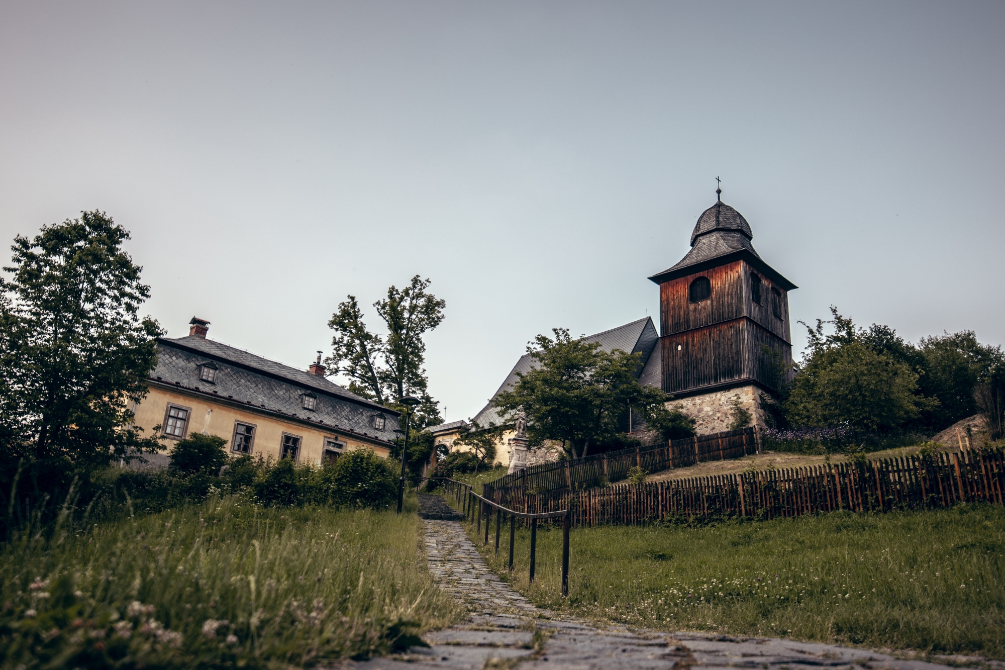
The Kryštofovo údolí valley lies east of Liberec, on the Rokytka river. In the past it was an old coal mining and smuggling settlement, which was allegedly founded in the...
Show more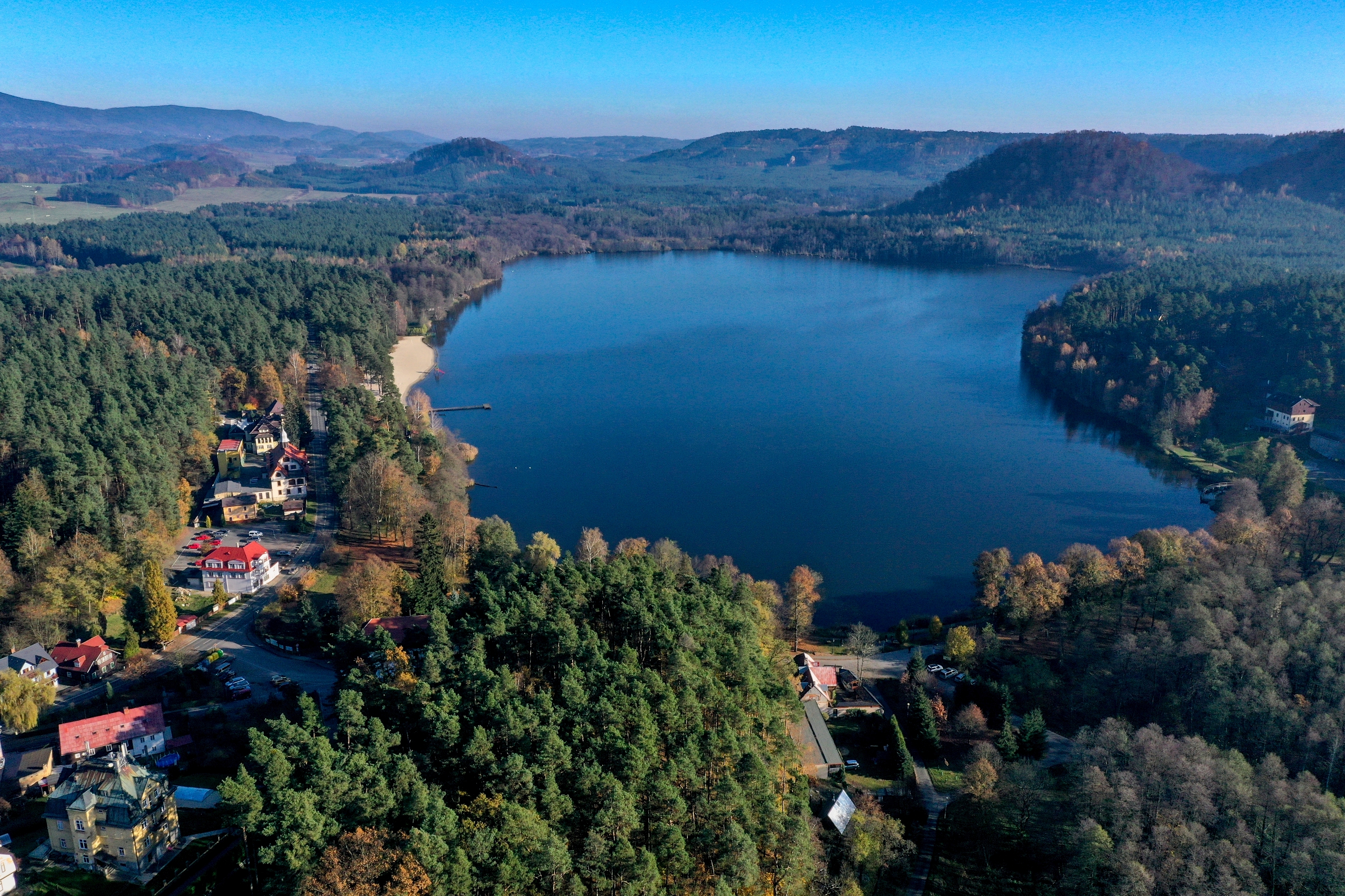
On the banks of the pond you will find a swimming pool, two campsites and a 400 m long sandy beach. In the swimming pool area there are water slides,...
Show more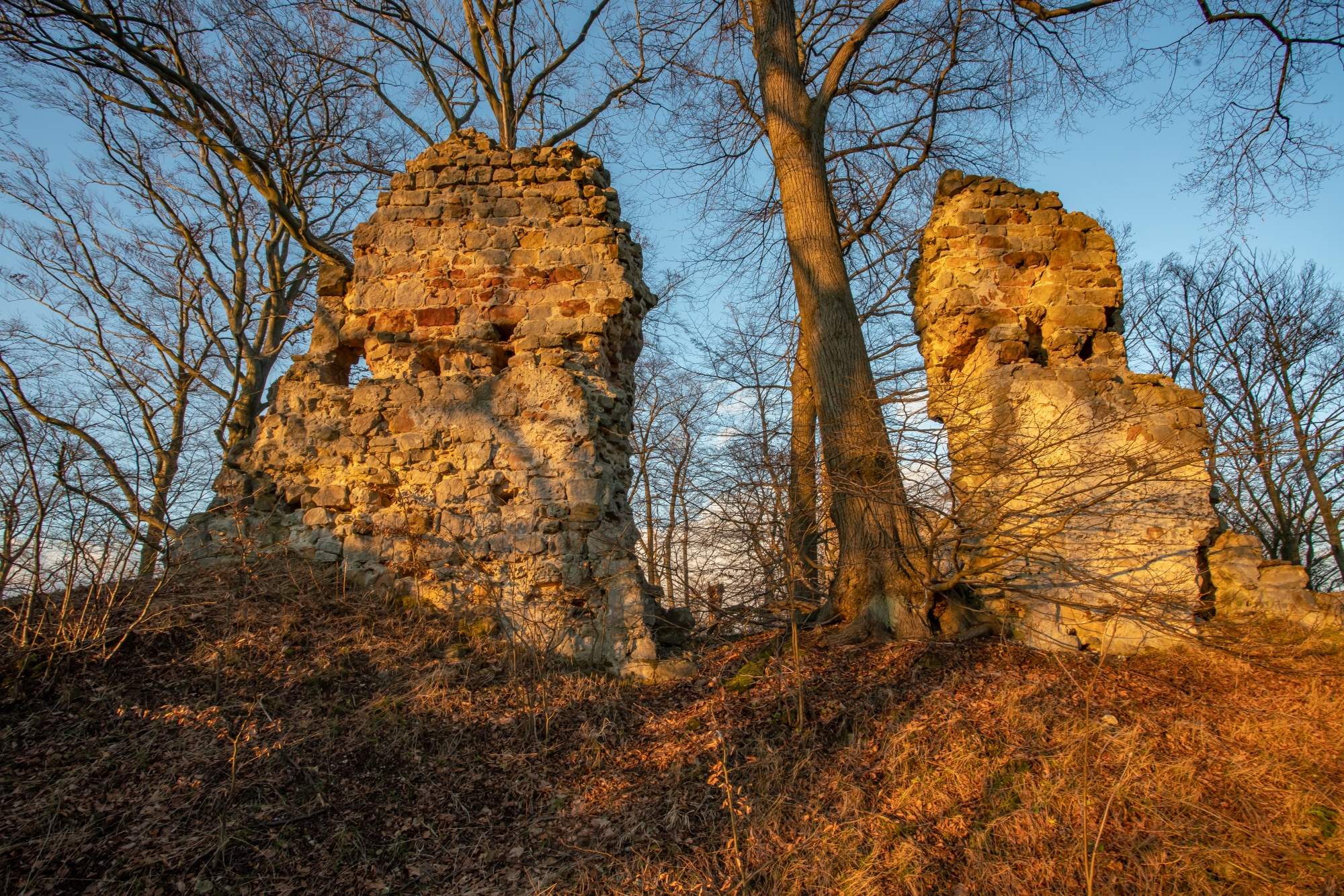
A royal castle was probably built on the site of an older hill fort around the middle of the 13th century, protecting the old trade route north to Lusatia. The...
Show more
